Saturday, December 13, 2008
Waikele Stream & Waipio Peninsula
Waikele means "muddy waters" and the water in the stream was very dark and muddy indeed after all the recent heavy rains. Sides of the steep stream beds were also eroding away and I saw an intact section of concrete steps, a section of chain link fence and some other things that had fallen down to the lower banks of the stream with the erosion. I wish I was able to stop and get a picture.
Waikele stream cuts through the center of Waipahu Cultural Park and enters into Pearl Harborʻs West Lock on the west side of Waipio Peninsula. Directly opposite on the east side of Waipio Peninsula was once a large fish pond called "Loko Eo". This fish pond is now coved by Ted Makalena golf course. Just south of this area on Waipio Peninsula is the large Waipio Soccer Complex that has been put here in more recent years. The soccer complex (288 acres) covers what was once another large fish pond called "Loko Hanaloa" which was 195 acres in size before it was filled in.
Waikele is the former name of Waipahu (Waipahu is in the ahupuaʻa of Waikele). The area between West Lock and Loko Eo was terraced throughout, continuing for more than a mile up into Waikele Stream. The lower terraces were fed with water from a famous spring at "Waipahu" which means"exploding water" (Native Planters of Old Hawaii, pp. 470 - 472). Waipahu was the name of the spring that was located near where the former Oʻahu Sugar Mill stands in Waipahu town.
Take a moment and pause to remember what was once in this area beneath your feet next time you travel through the old sugar plantation town of Waipahu or play golf or soccer on Waipio Peninsula.
Konahuanui


"Beautiful is (Mt) Konahuanui towering above Nuʻuanu Valley, a gourd holding dew, the mountain often has a mantle of cloud" (Native Planters of Old Hawaii" pp. 222).
So it did at the very peak of the mountain when I took the top picture a couple of days ago from Maunawili Valley. A couple hours later though, the peak had cleared (bottom picture).
Mount Konahuanui is the upper most elevation of nā ahupua'a of Kailua & Nuʻuanu. It is the highest peak in the Koʻolau mountains and the second highest peak on Oahu after Mount Kaʻala in the Waiʻanae mountains.
There is a famous legend about a moʻo that lived in a pool on Konahuanui peak. A hairless dog had been killed and was being taken to the kona side of the island through the Nuʻuanu Pali as a tribute to the aliʻi nui and to be eaten.
At the foot of the Pali in the hala groves of Kekele, the moʻo of Konahuanui called out Pehea lā, ke kaʻahele nei ʻoe? ("So, you are travelling?"). The killed and dismembered dog in the ʻumeke (calabash) called out ʻAe (yes). The carriers were so terrified that they dropped the calabash and fled. The hairless dog emerged alive from the laulau in the calabash and trotted up Mt. Konahuanui to meet the moʻo.
Consequently, no hairless dogs were ever eaten again (Native Planters of Old Hawaii" pp. 247-248).
Monday, December 1, 2008
Ahupuaʻa o Kahaluʻu


Kahaluʻu stream is fed by Ahuimanu, Waiola & Kalohaka streams further inland. Due to the topography of Kahaluʻu, the loʻi of this ahupuaʻa were not continuous, but were tucked away in pockets that were fed by these streams. Wet land and dry land type taro were grown in this area.
The seaward low elevation flat lands of the ahupuaʻa of Kahaluʻu and the two adjacent ahupuaʻa of Waiheʻe & Kaʻalaea to the northeast made up one of the largest wet land taro growing areas along the Koʻolau (windward) coast of Oahu (Native Planters of Old Hawaiʻi - p. 454).
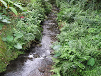
Ahuimanu stream is shown in the top picture. I took this picture about 100 yards upstream (ma uka) from where Ahuimanu steam is joined by Waiola stream.
The other two pictures show a nice stand of ʻOhe (bamboo) which was growing on an embankment above the stream. ʻOhe in traditional Hawaiʻi was used for many things including being made into musical pipes, rattles, fire blowing tubes, water containers & stamps for marking tapa.
The water of this stream on this day was crystal clear and the plants growing on the edges of the stream were indeed uluwehiwehi loa.
Sunday, November 30, 2008
Lā Kūʻokoʻa
Saturday, November 29, 2008
Limu Huki for Pōʻaono Nowemapa 29, 2008


Approx. 4500 lbs of invasive algae were pulled today from the reef flats at Paiko Beach. Mahalo nui to the 20 something volunteers who came out to lend their kōkua. Also, nui nui mahalo to all who contributed food & drinks, supplies, equipment & algae disposal means to make this another successful pull.
Thursday, November 27, 2008
Hauʻoli Lā Hoʻomaikaʻi
Saturday, November 22, 2008
State Observes First Makahiki Commemoration Day
Day focuses on peace, abundance, unity and conservation.
Today (Thursday, November 20th) marks the first official State observance of Makahiki Commemoration Day, which was designated for recognition by the 2008 Hawai‘i State Legislature. It is not a state holiday.
“Makahiki was a significant time throughout Polynesia,” said Senator J. Kalani English, the principal introducer of the bill that established Makahiki Commemoration Day. “Conflict and war were set aside for the four-month Makahiki season, and unity and peace prevailed. They also let the land lay fallow as they celebrated the harvest.”
To perpetuate the ancient wisdom of land conservation, abundance, unity and peace during the four months of Makahiki, Polynesian regional governments celebrate the Makahiki season and have designated November 20th as the start of the Makahiki observance. With today’s fist official observance of Makahiki Commemoration Day, Hawai‘i joins that group.
“This brings us closer to our land, our culture, and our brothers and sisters across Polynesia,” said English. “I hope everyone will take a moment today and reflect on all of our interconnections.”
Click on link below:http://www.hawaiisenatemajority.com/2008/11/20/state-observes-first-makahiki-commemoration-day/
Monday, November 17, 2008
Just a Thought about Agriculture in Maunalua - ʻUala


There was much more sweet potato (ʻuala) farming in the ahupua'a of Maunalua in ancient Hawai'i, and little or no kalo production due to the dryer environment of Maunalua. If an inland or ma uka type Hawaiian cultural & agricultural learning center were to be located somewhere in Maunalua in the future for the education of our keiki, community members and others, wouldn't it be befitting to have a focus or concentration on a crop that has much historical significance to this area such as ʻuala (see keiki ʻuala piko vines in pictures above).
Other wetter type ahupua'a in the islands revolve there activities & learning around kalo rightly so if that was a known location for kalo in the past and the environment is suitable for kalo growing. Maunalua could be a very unique and different learning place with the emphasis on ʻuala cultivation in which the valleys of Maunalua were once known for.
ʻUala was the second most abundant starch in the diet of the people of Hawai'i after kalo. There is rightly so, much emphasis on kalo today for many reasons including the religious & spiritual reasons which I will not go into in this post. The point being made here is that a place to learn about ʻuala cultivation and it's importance in old Hawai'i as an emphasis and in addition to other Hawaiian cultural and agricultural topics would be ideal in Maunalua. ʻUala cultivation is much less common to see and hear about as compared to kalo throughout the islands. Maunalua could play an important part in making ʻuala visible again in front of the community and in also developing a greater appreciation among many more of us for this important & culturally significant food item of old.
Although, Maunalua has been exposed to over-development of housing in recent years, there are still lands available where a learning center & possible community kitchen could be located that could allow for teaching of Hawaiian culture, cultivation & agricultural methods, proper ahupua'a based land usage & management, community gatherings and farmers open markets for the existing farmers and agricultural businesses in our community.
Maybe this is just the concept that will assist in keeping agriculture in our community for the long haul, bring the community closer together and help keep our last remaining pockets of rural Hawai'i alive and well in Maunalua.
Click here to learn more.
Tuesday, November 11, 2008
Read This!
Travels of the ʻAmaʻama & Awa
Kuapā fish pond was said to be connected to Kaʻelepulu fish pond in Kailua on the Koʻolau side of Oʻahu. ʻAmaʻama and awa were known to travel between these two ponds on the opposite sides of the Koʻolau mountain range via an underground tunnel.
When the ʻamaʻama fish disappeared from Kuapā pond they appeared in Kaʻelepulu pond. At the same time, the awa fish disappeared from Kaʻelepule and appeared in Kuapā. When the ʻamaʻama reappeared in Kuapā, the awa would disappear.
This same observation was made in more recent years by some of the Japanese fisherman who leased Kuapā pond. McAllister, Archeology of Oʻahu
Thursday, October 30, 2008
Invasive Algae Huki for Pōʻalua - ʻOkakopa 28


Aloha kākou,
Todayʻs tally was 4213 lbs of invasive algae pulled off Paiko Beach. Mahalo nui to all of the combined Mālama Maunalua and Nature Conservancy Crew for their good work.
The cleared plots are growing larger with each pull. We are only approx. 10 feet away from an area of native sea grass (Halophila hawaiiana) which is endemic to Hawaii. It will be interesting to monitor the cleared areas as we get closer to and meet the sea grass beds and see if the sea grass starts to take hold in the clearings.
Big mahalo to Glenn Nii and the Nii family for allowing us to drop pulled avrainvillea at their plant nursery in Kamilonui Valley (bottom picture). Also, big mahalo to Mark & Brooke Loughridge for allowing us to use one of their kayaks.


Sunday, October 26, 2008
Similarities Between Lokoea & Kanewai Fish Ponds
Lokoea is a fish pond of the Puʻuone type. Kanewai fish pond in Kuliʻouʻou is also of the Puʻuone type. The Puʻuone type fishponds are rare on Oʻahu. Puʻuone can mean "divination" or "pond near the shore".
A Puʻuone type pond is described of as a type of pond that is located near the shore. It's fresh water originates from streams or underground springs. Lokoea receives its water from an upwelling of springwater near Kawailoa which fed an adjacent fish pond called ʻUkoʻa. The water from ʻUkoʻa than flows into Lokoea. Kanewai receives it fresh water from underground springs that flow into the pond from Kuliʻouʻou Valley and Kuliʻouʻou ridge mauka of Kanewai.
These brackish water ponds are connected to the ocean by ʻauwai kai or salt water ditches. The ʻauwai of Lokoea is connected directly to the ocean and this ʻauwai extends beneath Kamehameha highway today where it connects to Waialua Bay. The ʻauwai of Kanewai is connected to Paiko Lagoon which inturn is connected to Maunalua Bay by an inlet in which I am guessing is approximately 50 feet wide.
The fresh water flow to both of these ponds has been reduced in more recent years by the diversion of water. In Lokoea's case, by Waialua Sugar Company when the land above Haleʻiwa was in sugar cane production. Kanewai fish ponds fresh water flow has been reduced by the widening of Kalanianaʻole Highway a few years back just as the neighboring Kalauhaeʻhae fish ponds fresh water flow has in Niu.
Monday, October 13, 2008
Invasive Algae Huki for Pōʻaono - ʻOkakopa 11


Big mahalo to all Malama Maunalua volunteers who came out on Saturday to pull invasive algae at Paiko Beach. Grand total pulled was 6335 lbs (give or take a few lbs). Over 3 tons......Amazing job by everyone!!!
Nui nui mahalo also to our regular Nature Conservancy Crew of Marion, Russell, Koa, Manuel, Janice & Pauline for all their support and in arranging this event. Also, big mahalo to Eric Co for getting us started on the whole seaweed removal project several months back and for his continuing support.
It was an honor to have the Nature Conservancy board members come out and visit us. Mahalo nui to all TNC board members for their hard work weighing and loading bags of algae on to the truck during their visit.
Mahalo to Kevin Mulkern for use of his companies truck and Holy Trinity School & Church for providing parking for Saturdays event. Mahalo to all who supplied food & drink during the day.


Sunday, September 28, 2008
ʻŌlelo Hawaiʻi at the Beach
The only rule being that Hawaiian is spoken as much as possible and English is kept to a minimum. More fluent speakers can help novices express words in Hawaiian as necessary. Itʻs all for fun and for using ʻōlelo Hawaiʻi as it should be used in Hawaii nei.
No shame for novices, myself being one. Just come and speak the best you can. Thatʻs how we all get better at speaking and listening. It is preferred that some Hawaiian language basic skills and usage be known. Many of us have this but lack people to speak to regularly. Another intent of this endeavor is to help fill that void.
Hawaiian language usage should expand more widely above and beyond the schools and mānaleo speaking communities of Hawaii. There should be informal groups accessible to all who want to use Hawaiian language in every ahupuaʻa and district of Hawaii. With that being said, wouldnʻt spoken Hawaiian spread throughout our communities and be common and vibrant again as it was pre-1900ʻs. What do you think? Please post a comment or email your thoughts or interest in participating.
Holomua ka ʻōlelo Hawaiʻi i ka lehulehu!
Seaweed Huki Tally for Pōʻalima, Kepakemapa 26

Fridayʻs seaweed pull tally was 2905 lbs. Mahalo nui to all from Mālama Maunalua & The Nature Conservancy who participated.
I believe the invasive algae that has been smothering out the native Hawaiian types of limu such as the nasty mudweed (avrainvillea) that we are pulling out is not deserving of being called "limu". So I call it "seaweed" and save the word "limu" for the maikaʻi native types of limu of Hawaiʻi.
If you look at the two bottom pictures, you can see the borders of where we have removed invasive seaweed and where it is still growing (top left corner of Pic. 1 & middle of picture in Pic. 2).
1.

2.

Sunday, September 14, 2008
Aloha nō e Leighton


Bradda Leighton was reunited with the ocean yesterday off Maunalua for the first since his prolonged illness over the last 4 years after suffering from a diving accident. Family and many friends were at Maunalua Beach Park to celebrate his life.
As a well know waterman, Leighton Look was remembered for his many talents including being an expert paddler and steersman, founder and coach of Hui Lanakila Canoe Club, expert carpenter, canoe builder and paddle maker, commercial fisherman, UH Manoa civil engineering graduate, Kalani High School football team linebacker in the early 1970's and many other things.
Leighton and his younger brother and my good friend Les helped me put in a nice big driveway at my folks house in Niu several years back. They also hosted many crazy parties including the biggest New Years eve parties with more fireworks than one could imagine. Leighton always would let my kids have as much fireworks as they wanted after their supply ran out. He always had coolers full of them. He would dive and fish days in advance of the parties and have the best food available with every imaginable seafood on the table.
Leighton will be really missed by his family, the paddling community & all the gang from Niu Valley who knew him since small kid time.
Aloha nō e Leighon a hui hou kākou i ka palekaiko o ko kākou Hakulani.


Wednesday, September 10, 2008
Yesterday's Limu Huki Tally
Monday, September 8, 2008
Ke Kuahiwi o Hawaii Loa

1.

2.

3.

Hawaii Loa ridge between the Ahupua'a o Niu and the Ahupua'a of Wailupe still displays many native plant species from the original native Hawaiʻi dryland type forests which once covered much of the land in this area.
Koa (pic. 3), Maile (pic. 5), ʻIlima (pic. 7), ʻŌhiʻa Lehua (pic. 6), Lama, Naupaka Kuahiwi (pic. 4) & ʻIliahi or Sandalwood (pic. 1 & 2) are just some of the native plants & trees that can still be found here.
The Sandalwood trade, the introduction of foreign plants and trees and the introduction of cattle in the 1800's changed the landscape to a drastic extent. For example, the Kiawe tree which was prevalent in the valleys and lower hills of this area before homes were built was brought in to Hawaiʻi. It was quickly spread all over the place by the cattle which ate the Kiawe beans. The amount of invasive guava on the ridge is alarming as it is in many other areas.
The park and trail head on Hawaii Loa ridge is now at a place in which we once as kids called the dust bowls. The dust bowls were giant eroded out areas of red dirt. The dust bowls were our final destination as kids after hiking up the ridge from the highway and up through where all those million dollar homes are now, or up the side of the ridge where the gorge is above Niu Valley Intermediate School and tennis courts.
In those days Pheasant could be seen flying from the bushes and wild dogs were in the mountains and deep in the valleys which made it quite spooky wondering if you would ever run into them while hiking. Our weapons of choice were pellet and BB guns to defend ourselves and shoot at stuff. I never ran into the wild dogs; however, my family saw them on occasion from a distance in the Niu Valley school grounds and adjacent hills in the 1950ʻs and early 1960ʻs. I did see large dog foot prints in the dust bowls periodically though. Also, the dogs would dig into the deep piles of ironwood needles and make dens for the pups. We saw these ironwood needle dens often in the dust bowls and surrounding areas of the mountain.
There was no trail than behind the dust bowls as there is today that leads up to the top of the Koʻolau mountains (top picture) where you can look over to the windward side of the island to Waimanalo & Kailua.
4.

5.

6.

7.

Monday, September 1, 2008
Limu Huki


Another nice harvest of invasive algae was completed on Friday, August 29 by members of Mālama Maunalua and with the support of The Nature Conservancy.
Approx. 3540 lbs of invasive algae were pulled from the reef in front of the Kuliouʻou/Paiko area. Cleared areas are slowly growing bigger; however, the work is only in the beginning stages.
We load bags of seaweed on the Kayak and push it to shore where we unload the bags, than wheel barrow it to the road and load it on trucks. The work is labor intensive but we always have lots of fun. Maybe at some point, we can get the Seaweed Super Sucker back on the reef and use that again to see how it compares to hand pulling.
Avrainvillea amadalpha (mud weed), Gracilaria saliconia (gorilla ogo) and Acanthophora spicifera (prickly seaweed) are especially thick types of invasive algae in this area. After the removal of the invasive algae, the goal is to restock this area with native limu like "Limu Manauea" and other native species in which many areas in Maunalua Bay were once famous for.


Kalauhaʻehaʻe


Kalauhaʻehaʻe also called Lucas Spring is located in the Ahupuaʻa o Niu (above). It is a historic site and a wahi pana. The Maunalua Fish Pond Heritage Center, the community and the University of Hawaii at Mānoa are actively working together at this time to preserve this site.
The goal besides saving the site is to restore it to its original pristine quality as a fish pond and to use it for cultural and educational purposes through the University of Hawaiiʻs Hawaiian Studies Department.
Much of the fresh water flow to the stream was cut off during the widening of Kalanianaʻole Highway approx. 10 years ago. Upon restoring the below ground fresh water flow from the mauka side of the highway, the pond could become productive again.
Also, it would also create a vast improvement in the adjacent Maunalua Bay area where efforts are ongoing by Mālama Maunalua. Data collection, fish monitoring, invasive algae removal and other community projects administered by Mālama Maunalua are underway to stop degradation and restore the pristine quality of the bay.
Thursday, August 28, 2008
Ka Lae o ka ʻŌʻio


Ka Lae o ka ʻŌʻio is the point that extends out into the ocean as you round the turn on Kamehameha highway at the end of Kualoa and enter the beginning of Kaʻaʻawa (as you head towards Kahuku -top picture above).
Ka Lae o ka ʻŌʻio not only separates nā ahupuaʻa of Kualoa and Kaʻaʻawa. It also separates nā moku (districts) of Koʻolaupoko and Koʻolauloa.
Kanehoalani hill or ridge directly above Ka Lae o ka ʻŌʻio is steeped in legend (bottom picture). The famous burial cave of aliʻi called Pohukaina located in this ridge is said to have once had many entrances and extend through out the Koʻolau mountains.
There was also a spring above Ka Lae o ka ʻŌʻio called Kaʻahuʻula. Kaʻahuʻula spring was reportedly destroyed by the US army during WWII when a gun site was built above and earth and rock from the gun site area covered the spring. The gun site can be seen to this day.
I am not positive as to the exact meaning of Ka Lae o ka ʻŌʻio except that with the kahakō over ʻŌʻio it means "The Point of the Bone Fish". Without the kahakō over ʻOʻio, ʻOʻio means "procession of ghosts of a departed chief and his company" per the Pukui/Elbert "Hawaiian Dictionary". I have seen it labeled in some texts as "The Point of the Bone Fish"; however, if you read about Pohukaina Cave and Kanehoalani ridge above, possibly "The Point of the Departed Chief" would be accurate also?
Sunday, August 24, 2008
Hawea Heiau


Hawea heiau is located at the foot of Kaluanui Ridge (Mariners ridge) in the ahupuaʻa o Maunalua.
Remnants of the ancient site are where the coconut grove is located (see pictures above). This grove is near marshy land. Water holes in this area once provided fresh water when it rained to people living or passing through the area. Also, in ancient times there was a spring in this area called Waiakaʻaia which provided fresh water (History of Hawaii Kai & Maunalua - pg 34).
According to Levi Chamberland, a missionary who traveled through the Maunalua area in the early 1800ʻs, there was a village near where the Hawaii Kai Recreation Center is located now. This village according to him was called Keawaʻawa.
He counted nearly 100 huts in this area in which my guess would be that they were a combination of hale pili (thatched huts) and pāpaʻi lawaiʻa (fishermens huts). The inhabitants were mostly kānaka lawaiʻa (fishing people).


