Before the Ala Wai canal was built in the 1920's, mauka streams draining from the ahupua'a areas of Palolo, Manoa and Makiki filled swampy land, ponds and rice fields in what we now known as Moili'ili, McCully and the Waikiki area mauka of Kalakaua Ave.
These marsh lands drained into three streams that extended makai through the Waikiki area. The stream on the east edge of Waikiki was near what is now Kapahulu Ave. This stream was called Ku'ekaunahi. The stream on the west edge of Waikiki drained into the sea where Ft. Derussy is today and was called Pi'inaio. The middle stream running dead center through Waikiki was called 'Apuakehau. 'Apuakehau entered the ocean where the Outrigger Hotel is today on Kalakaua Ave. (between the Moana Hotel and the Royal Hawaiian Hotel). Kaiualani Ave. covers the original path of 'Apuakehau stream.
The ancient and famous surfing spot called Kalehuawehe was located just outside the mouth of the stream (probably about where Canoe's surfing spot is located today). 'Apuakehau stream formed a muliwai (lagoon) just before it entered the ocean.
On the west bank of 'Apuakehau stream approximately where the Royal Hawaiian Hotel is today was the royal coconut grove at Helumoa. If you walk through the beautiful gardens of the Royal Hawaiian Hotel - some of the tall coconut trees standing there today are remnants of that grove.
The famous chief of O'ahu in the 1500's, Kakuhihewa lived at Ulukou on the east bank of 'Apuakehau stream which is now where the Moana Hotel stands.
'Apuakehau nor any of the other steams mentioned above exist anymore. At least as they once did on the surface of the land. However, we are reminded that the spirit of 'Apuakehau is not dead - it flows below ground and during heavy rains the Outrigger hotels basement parking garage reportedly often floods with water. The water originates from drains in the garage floor. This is the water of 'Apuakehau which still runs below ground under the buildings and streets that now cover Waikiki. See Down Wind Productions website for interesting facts, comments and pictures about Waikiki and 'Apuakehau stream.
Monday, January 22, 2007


Monday, January 15, 2007
Maniniholo Dry Cave
In the Kaiwiku'i mountain ridge in the Ha'ena ahupua'a of Kaua'i there is a large cave at the base of the ridge called Maniniholo. Maniniholo was the name of the head fisherman at a time when the menehune were leaving Kaua'i.
Maniniholo and is workers once gathered an abundance of seafood from the reefs and bay at Ha'ena for a feast. They did this to honor the menehune before their departure from the island.
Since there was such a great amount of food gathered, some of the food remained after the feast. During the night, the remaining food disappeared.
Maniniholo realized that the e'epa had taken the food after seeing them in the lava cracks in the sides of the cliff above the beach. He and his workers dug into the cliff and killed the e'epa (Wichman, Kaua'i - Ancient Place Names & Their Stories - p. 127-128).
The Maniniholo dry cave is located adjacent to the main road and is across from Ha'ena Beach Park.
Maniniholo and is workers once gathered an abundance of seafood from the reefs and bay at Ha'ena for a feast. They did this to honor the menehune before their departure from the island.
Since there was such a great amount of food gathered, some of the food remained after the feast. During the night, the remaining food disappeared.
Maniniholo realized that the e'epa had taken the food after seeing them in the lava cracks in the sides of the cliff above the beach. He and his workers dug into the cliff and killed the e'epa (Wichman, Kaua'i - Ancient Place Names & Their Stories - p. 127-128).
The Maniniholo dry cave is located adjacent to the main road and is across from Ha'ena Beach Park.
Tuesday, January 9, 2007
Kanoenoe Plain
Central Oahu is loaded with many ancient place names that are no longer commonly called by these names. One of these names is Kanoenoe plain. This area falls within the ahupua'a of Waipio in the Ewa district.
Kanoenoe plain is the area which is now covered by the Central Oahu Regional Park. This is a newer park of good size that was completed within the last couple of years. It is located just south of Kipapa Gulch and west of the Waipio Gentry residential development. Before the park, the land was covered by pineapples and before that, possibly sugar cane.
Some of the place names of the old central Oahu area are included in a poem that was as follows:
The icy wind of Lihu'e plied its spurs,
Pulling up the bridle of Hale'au'au,
Speeding headlong over Kalena
And running over the plain of Kanoenoe.
Na Wahi Pana O Ewa
Ka Loea Kalaiaina, July, 22, 1899 Newspaper
Sterling & Summers, Sites of Oahu p. 21
Kanoenoe plain is the area which is now covered by the Central Oahu Regional Park. This is a newer park of good size that was completed within the last couple of years. It is located just south of Kipapa Gulch and west of the Waipio Gentry residential development. Before the park, the land was covered by pineapples and before that, possibly sugar cane.
Some of the place names of the old central Oahu area are included in a poem that was as follows:
The icy wind of Lihu'e plied its spurs,
Pulling up the bridle of Hale'au'au,
Speeding headlong over Kalena
And running over the plain of Kanoenoe.
Na Wahi Pana O Ewa
Ka Loea Kalaiaina, July, 22, 1899 Newspaper
Sterling & Summers, Sites of Oahu p. 21
Sunday, January 7, 2007
Kamilonui


 Kamilonui Valley which lies in the ahupua'a of Maunalua in the Kona district of Oahu is one of the last valleys of significant size in all of Honolulu which remains undeveloped.
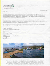
The land is used primarily for agricultural purposes at this time. The valley is under threat of development even though farmers leases extend for approx. 15 more years. See letter I wrote to the Honolulu Advertiser Editor in 2005 which addresses the valley and the adjacent heiau called Pahua.
Rock shelters and burial caves were once used in the valley (Sites of Hawaii, p. 264). One of the larger caves above the old Kaiwi road which use to extend to the back of the valley (along the east side) is visible half way up the ridge on the northeast side of the valley.
Although, Kamilonui valley was once included in the larger Maunalua ahupua'a, the valley has nearly all of the elements of a traditional ahupua'a. The base of the valley lacks a large seafront area; however, it does contact the tip of Kuapa pond which is connected to the sea. This valley would be an ideal location to put into practice traditional dryland cultivation and to serve as a model of a traditional ahupua'a system extending from mauka (low mountain peak of Ko'olau mountains above the valley) to makai (mauka tip of Kuapa pond).
There is a stream in the valley that extends to the mauka tip of Kuapa pond that has water flowing through it with aquatic life. The flow does become heavy during rainy weather with the lower portion of the valley adjacent to stream prone to flooding.
Could this valley not serve as a model ahupua'a in which other areas (ahupua'a) developed or not, could learn from? Also, the use, management and cultivation of a dryland type ahupua'a could be observed and studied in contrast to a wetter type ahupua'a such as for example - Kahana valley. Pictures of Kamilonui valley, Pahua heiau and cave on east side ridge of valley are shown above.
Wednesday, December 27, 2006
Waolani
Waolani is a small valley located within the larger Nu'uanu valley. Nu'uanu valley is located mauka of downtown Honolulu. O'ahu Country Club now occupies much of Waolani valley. Legend states that the e'epa people once lived in this valley. The e'epa were similar to the menehune. Both of whom were known for being active and working at night.
Many heiau including some of the earliest were located in Waolani. A holua slide may have also previously been situated at the end of a ridge that separates Waolani & Nu'uanu valleys (McAllister - Arch. of Oahu - Sites of Oahu p. 304). I believe the ridge being described is Kekoalani ridge.
One of the famous heiau here was called Kawaluna. The heiau was sacred or a Po'ohonua (Place of Refuge) to all who were sick or who suffered from a wide range of strange ailments (McAllister, Arch. of O'ahu - Sites of Oahu p. 304).
A great battle occurred in Waolani several hundred years ago between ali'i from the Ko'olaupoko and Kona districts of O'ahu. The battle ended in the submission by the Kona ali'i to Kuali'i, the chief from Ko'olaupoko and also the mo'i of O'ahu at that time. Kuali'i than returned to Kailua in the Ko'olaupoko district. This battle was called the "Battle of Kawaluna" (Fornander, Polynesian Race, Vol. II - Sites of O'ahu p. 304).
The Kawaluna battle was in Waolani valley in the Kona district and the winner of this battle was an ali'i from the neighboring Ko'olaupoko district on the opposite (windward) side of the Ko'olau mountains. In speculation on my part, the Kona chief(s) must have felt a strong resentment towards Kuali'i (even with his status as mo'i of O'ahu) to come into their district and exert authority over them on their own grounds. The resentment (or other unknown reason) was obviously strong enough on the Kona chief(s) part to cause them to attempt to resist Kuali'i.
Many heiau including some of the earliest were located in Waolani. A holua slide may have also previously been situated at the end of a ridge that separates Waolani & Nu'uanu valleys (McAllister - Arch. of Oahu - Sites of Oahu p. 304). I believe the ridge being described is Kekoalani ridge.
One of the famous heiau here was called Kawaluna. The heiau was sacred or a Po'ohonua (Place of Refuge) to all who were sick or who suffered from a wide range of strange ailments (McAllister, Arch. of O'ahu - Sites of Oahu p. 304).
A great battle occurred in Waolani several hundred years ago between ali'i from the Ko'olaupoko and Kona districts of O'ahu. The battle ended in the submission by the Kona ali'i to Kuali'i, the chief from Ko'olaupoko and also the mo'i of O'ahu at that time. Kuali'i than returned to Kailua in the Ko'olaupoko district. This battle was called the "Battle of Kawaluna" (Fornander, Polynesian Race, Vol. II - Sites of O'ahu p. 304).
The Kawaluna battle was in Waolani valley in the Kona district and the winner of this battle was an ali'i from the neighboring Ko'olaupoko district on the opposite (windward) side of the Ko'olau mountains. In speculation on my part, the Kona chief(s) must have felt a strong resentment towards Kuali'i (even with his status as mo'i of O'ahu) to come into their district and exert authority over them on their own grounds. The resentment (or other unknown reason) was obviously strong enough on the Kona chief(s) part to cause them to attempt to resist Kuali'i.
Wednesday, December 20, 2006
Makahoa Point
Northern point of the Malaekahana ahupua'a in the Ko'olauloa distrct of Oahu. A fishing shrine for the 'o'io fish was once located on the point. Also, a fish pond called Waipunaea was located near here. Adams field named after Andrew Adams, a Kahuku plantation manager in the early 1900's is located just inland of the point. Mokuauia island (Goat Island) lies on the opposite southern side of the bay.
Certain schools of mullet are said to originate from a place in Pu'uloa (Pearl Harbor) and swim around the southeast end of Oahu, around Makapu'u, and up the windward coast to Makahoa Point. Once they reach here, the schools of mullet disappear (McAllister, Arch. of Oahu). What happens to them is not known; although, it has been said that they may enter an unidentified sea cave or ocean tunnel.
If you have ever camped at the northern Malaekahana camp sites, you may have walked out to this point from the beach. On the way out to the point you have to cross Kaukanala'au stream which empties into the north portion of the bay. Makahoa Point is wind swept and horses sometimes graze here.
Certain schools of mullet are said to originate from a place in Pu'uloa (Pearl Harbor) and swim around the southeast end of Oahu, around Makapu'u, and up the windward coast to Makahoa Point. Once they reach here, the schools of mullet disappear (McAllister, Arch. of Oahu). What happens to them is not known; although, it has been said that they may enter an unidentified sea cave or ocean tunnel.
If you have ever camped at the northern Malaekahana camp sites, you may have walked out to this point from the beach. On the way out to the point you have to cross Kaukanala'au stream which empties into the north portion of the bay. Makahoa Point is wind swept and horses sometimes graze here.
Sunday, December 17, 2006
Pu'u o Moloka'i
Not of the island of Moloka'i, but of a small hill in the Waimanalo ahupua'a in the Ko'olaupoko district of Oahu.
Long ago a man from Moloka'i migrated to Waimanalo and took refuge on this hill. Soon after, others from Moloka'i followed and lived also on this hill. Over a period of time, these people and there descendents lost their identity as people being from Moloka'i and were absorbed by the people of Waimanalo. (Oahu Place Names - Bishop Museum)
The hill was said to have been in an old cane field in the vicinity of (across from) Waimanalo park. It would be of interest to know if Pu'u o Moloka'i disappeared long ago, if it disappeared in more recent times when residential development occurred or if the hill still exists in some way, shape or form?
Long ago a man from Moloka'i migrated to Waimanalo and took refuge on this hill. Soon after, others from Moloka'i followed and lived also on this hill. Over a period of time, these people and there descendents lost their identity as people being from Moloka'i and were absorbed by the people of Waimanalo. (Oahu Place Names - Bishop Museum)
The hill was said to have been in an old cane field in the vicinity of (across from) Waimanalo park. It would be of interest to know if Pu'u o Moloka'i disappeared long ago, if it disappeared in more recent times when residential development occurred or if the hill still exists in some way, shape or form?
Subscribe to:
Posts (Atom)




 Posts
Posts


